


 Comprehensive weather insights help safeguard your operations and drive confident decisions to make everyday mining operations as safe and efficient as possible.
 Learn how to optimize operations with credible weather and environmental intelligence. From aviation safety to environmental compliance, our comprehensive suite of solutions delivers real-time insights, advanced forecasting, and precise monitoring capabilities.
 Freezing rain occurs when precipitation falls through a warm layer, completely melts, and lands on a surface with temperatures below freezing. All forms of transportation are affected, trees are damaged, and extensive power outages can occur. Power lines can be affected in three ways (or a combination thereof); the weight of the ice, tree branches
Category: Weather
Using Weekend Weather Briefings To Disseminate Weather And Pavement Forecasts

In addition to the weather and pavement forecasts we provide via our maintenance decision support system – Iteris MDSS – we are proud to provide weekend weather briefing videos to customers around the country.
How To Help Overcome Holiday Season Road Maintenance Challenges
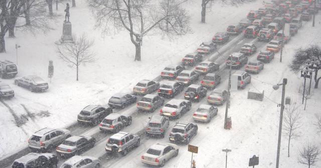
With estimates of more than 100 million people swarming U.S. roads and airports during the holiday season, the last thing transportation agencies need is winter weather adding to their laundry list of road maintenance problems.
United Nations Day: Climate Smart Initiative Update
Climate Smart Initiative This past July, DTN participated as a thought leader in a side event of the United Nations’ High-Level Political Forum 2018 (HLPF) in New York City. The meeting was organized by the Permanent Mission of Kazakhstan to the United Nations to feature mechanisms for global partnerships and sustainable development. DTN had the
Artificial Intelligence And Its Uses In Ag Irrigation
Weather Risk: How the Oil and Gas Industry Saves Billions
Most people understand the value that weather forecasts bring to the general public. They tell us whether it will be a good beach day, how much to bundle up at the football game, and if it’s necessary to bring an umbrella to work. However, the benefits of weather information provided to businesses by the private
What We Can Learn From The MDSS Pooled Fund Study
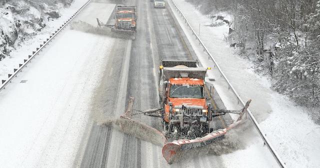
As the winter months approach, road maintenance officials will no doubt be recalling the comments and complaints they were inundated with during last year’s blizzard.
Sourcing Global Weather Data for Precision Forecasting in the Private Sector
In my previous article, I wrote about the vital partnership between the National Weather Service and private weather companies and how each brings an essential function to the weather enterprise. In this article, I’d like to tell you more about how a private weather company, such as WDT, builds forecasts from a variety of sources
Is the National Weather Service a Competitor to the Private Weather Sector?
There are two questions I’m often asked by friends, acquaintances, and even colleagues in the weather industry: “Is the U.S. National Weather Service a competitor of DTN?” and “What does a private weather company like DTN do?” To the first question, I respond that DTN is not a competitor to the NWS, nor are other
Hurricane Florence

We at MetStat, now DTN, are watching with bated breath as Hurricane Florence tracks westward toward the Carolinas. At this time, the most widespread impacts will be flooding from torrential rain, though areas near the coastline will experience intense and destructive winds as well. National Hurricane Center Risk of Flash Flooding for Hurricane Florence National